Build a regular grid based on an sf object or a SpatialPolygonsDataFrame.
getGridLayer(x, cellsize, type = "regular", var)Arguments
- x
an sf object, a simple feature collection or a SpatialPolygonsDataFrame.
- cellsize
targeted area of the cell, in map units.
- type
shape of the cell, "regular" for squares, "hexagonal" for hexagons.
- var
name of the numeric variable(s) in x to adapt to the grid (a vector).
Value
A grid is returned as an sf object.
Examples
library(sf)
mtq <- st_read(system.file("gpkg/mtq.gpkg", package="cartography"))
#> Reading layer `mtq' from data source
#> `/tmp/RtmpmpfIrO/temp_libpath18ee15f22a9e/cartography/gpkg/mtq.gpkg'
#> using driver `GPKG'
#> Simple feature collection with 34 features and 7 fields
#> Geometry type: MULTIPOLYGON
#> Dimension: XY
#> Bounding box: xmin: 690574 ymin: 1592536 xmax: 735940.2 ymax: 1645660
#> Projected CRS: WGS 84 / UTM zone 20N
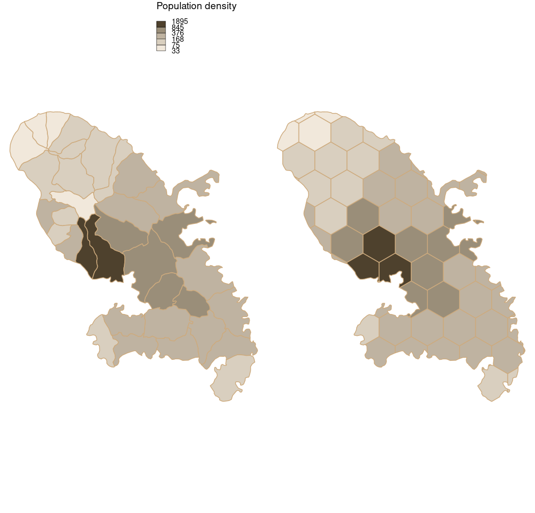
# Plot dentsity of population
mtq$POPDENS <- 1e6 * mtq$POP / st_area(mtq)
bks <- getBreaks(v = mtq$POPDENS, method = "geom", 5)
cols <- carto.pal(pal1 = "taupe.pal", n1 = 5)
opar <- par(mfrow = c(1,2), mar = c(0,0,0,0))
choroLayer(x = mtq, var = "POPDENS", breaks = bks,
border = "burlywood3", col = cols,
legend.pos = "topright", legend.values.rnd = 0,
legend.title.txt = "Population density")
mygrid <- getGridLayer(x = mtq, cellsize = 3e7,
type = "hexagonal", var = "POP")
## conversion from square meter to square kilometers
mygrid$POPDENSG <- 1e6 * mygrid$POP / mygrid$gridarea
choroLayer(x = mygrid, var = "POPDENSG", breaks = bks,
border = "burlywood3", col = cols,
legend.pos = "n", legend.values.rnd = 1,
legend.title.txt = "Population density")
 par(opar)